Recent Storm Center
Local Weather Events
This Recent Storm Center allows you to see our log of recent home-damaging weather events that occurred in the greater Louisville area.
To protect your property from future events, sign up for our storm monitoring service.
April 13, 2022
Recent Storm Center
- A quasi-linear convective system (organized line of thunderstorms) coming through our area caused strong gust winds and even some embedded supercells where tornadoes could form.
- Southeastern Louisville and counties to the east and south experienced several tornadoes from this storm. The tornadoes ranged from EF-0 (40-72 mph) up to EF-1 (73-112 mph).
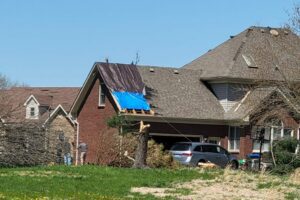
- Roofs were reported to be torn off in the Fern Creek area.
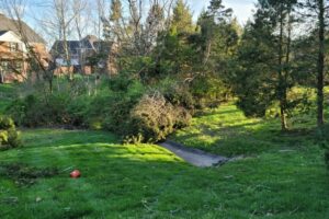
- Trees were reported down in the Glenmary Subdivision.
- The tornado in the Fern Creek and Glenmary area was estimated with winds of 95 mph from damage, giving the tornado an EF-1 rating.
- Hail and high winds hit Mt. Washington.
- Significant hail reported in Elizabethtown.
- Tornado warnings in Shelby County and Taylorsville.
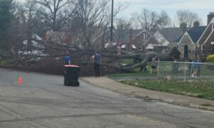
- Large trees down on Bluelick Road completely shut off the road.
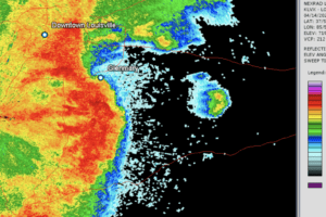
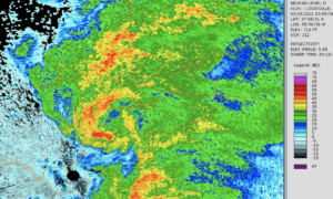
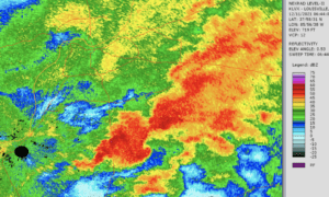
- Base Reflectivity radar at 8:26 pm EDT. Bow echo south of Glenmary indicates very high winds. High winds were reported throughout Louisville in the front of the storm. Heavy rain fell over the area during the storm. An inflow notch can be seen over Glenmary where the EF-1 tornado impacted.
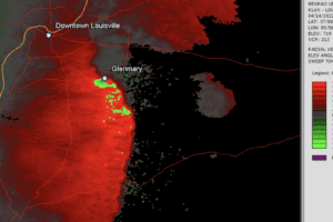
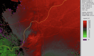
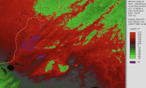
- Velocity radar at 8:26 pm EDT. Strong leading straight-line winds can be seen on the front of the storm. Rotation is apparent over Glenmary, the location of the EF-1 tornado.
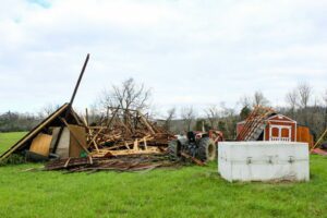
- Storm damage in Shelby County. Winds estimated at 90 mph from an EF-1 tornado.
- Storm damage in Shelby County. Winds estimated at 90 mph from an EF-1 tornado.
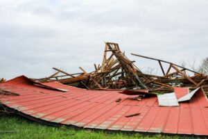
- Storm damage in Jefferson County. Winds estimated at 95 mph from an EF-1 tornado.
- Storm damage in Jefferson County. Winds estimated at 95 mph from an EF-1 tornado.
March 30, 2022
- Downed tree from the high winds in the afternoon of March 30, 2022. 60+ mph winds were recorded in Jefferson County during the event.
- High winds impacted much of Kentucky including the Louisville area.
- Winds were present ahead of an advancing cold front.
- The Louisville International Airport ASOS Mesonet Station reported gusts up to 63 mph.
- The Bowman Field Airport ASOS Mesonet Station reported gusts up to 68 mph.
- Damage to roofs and trees were observed as of result from the strong winds.
March 18, 2022
- Base Reflectivity Radar as of March 18 at 11:10 pm EDT.
- Velocity Radar as of March 18 at 11:10 pm EDT.
- The storms were within the leading line of a cold front.
- A rotating area within the storm including strong winds entered Jefferson County, causing a tornado warning in Louisville. Tornado sirens were implemented in the city.
- Louisville International Airport (SDF) within the path of the winds reported a gust of 68 mph.
- The area of winds tracked to the Northeast from West Point through Prospect.
- A second area of rotation caused tornado warnings near Elizabethtown
- Light rain and weaker winds impacted throughout the rest of Jefferson County.
December 11, 2021
- Base Reflectivity as of December 11, 2021 at 3:44 am EST.
- Velocity Radar as of December 11, 2021 at 3:44 am EST.
- The storm is known for the impacts on December 10, but is listed as December 11 because the Louisville impacts were after midnight.
- An outbreak of severe storms and tornadoes impacted the Ohio River and Mississippi River Valleys, including Arkansas, Missouri, Tennessee, and Kentucky.
- The storms were caused by excessively warm moist unstable air in the front of an advancing cold front.
- Supercell rotation passed over Shepherdsville and Mt Washington, Kentucky, with 60+ mph winds.
- Winds ranged from 30-40 mph for the rest of Jefferson County.
- A small EF-0 tornado was reported in Bullitt County.
- The strongest tornado was the EF-4 (190 mph) wedge tornado that destroyed Downtown Mayfield. This tornado was originally inaccurately labeled as the Quad-State Tornado. The tornado dissipated in Breckenridge County, about 70 miles to the Southwest of Louisville.
More Resources
Find comprehensive roofing resources to help you learn more about roofs and how to choose a quality roofing contractor.
